

The German Armed Forces have put into operation a new software platform that turns more than 800,000 radar data points per hour into displays of bird movements, helping specialists warn military aircrews of potential collision hazards.
The Bundeswehr unveiled the system on August 27, 2026. Known as VoVisWxBw, it was developed by the Bundeswehr Center for Digitalization and Capability Development of the Cyber and Information Domain in cooperation with the Bundeswehr Geoinformation Center (ZGeoBw).
Development was completed at the end of 2025 after a process lasting several months. The platform replaced an older application used to collect and evaluate radar data for military bird-migration warnings, which the Bundeswehr described as technically obsolete and increasingly difficult to maintain.
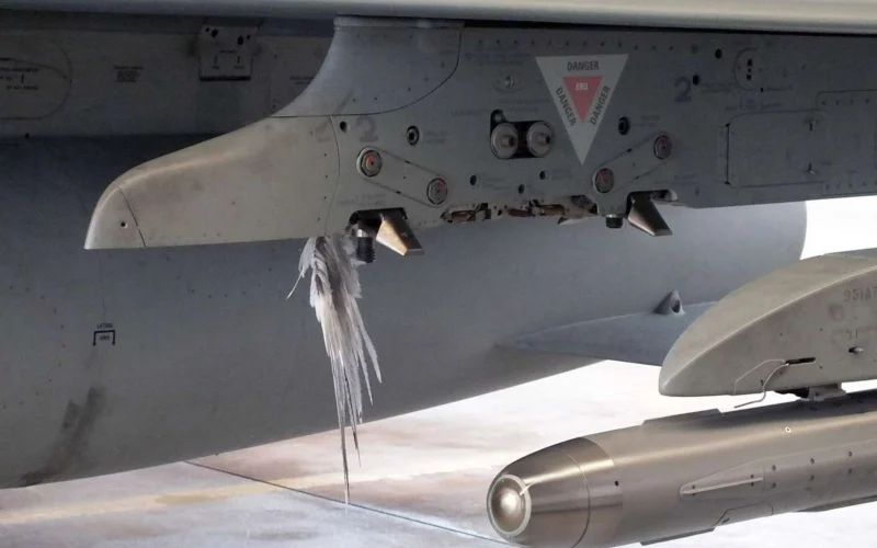
The Bundeswehr records more than 130 collisions with birds each year. In 2024, 10% of the wider category of wildlife-strike incidents recorded during flight operations resulted in damage.
Military aviation can be particularly exposed because training and operational flights are frequently conducted at low altitude. A ZGeoBw technical paper published in 2021 noted that these altitude bands can contain large numbers of birds, increasing the collision risk during military cross-country flights.
From radar echoes to bird-strike warnings
VoVisWxBw presents incoming radar information in two- and three-dimensional views. Operators can compare current returns with historical radar echoes, examine moving loops to identify the direction and development of flocks, and overlay maps showing protected bird areas.
Bird movements can change rapidly with wind, temperature, precipitation, and other weather conditions, particularly during the spring and autumn migration periods. Access to current and archived radar information allows specialists to assess how those conditions are affecting the location, altitude and intensity of migration.
BIRDTAMs feed into flight planning and restrictions
The Bundeswehr describes the platform as providing real-time analysis. Specialist personnel at ZGeoBw interpret the radar patterns and use the results to prepare BIRDTAMs, or Bird Notices to Airmen. BIRDTAMs contain a validity area, an intensity level and a warning zone defined through the World Geographic Reference System.
Those warnings are made available to both military and civilian users. They identify areas where bird activity may create an elevated hazard, allowing the risk to be considered during flight planning and operations.
The Bundeswehr begins restricting flight operations when bird activity reaches intensity level five.
Developed with the specialists who use it
VoVisWxBw also incorporates a database for reviewing earlier radar returns, and animated sequences for studying flock movements.
The software was developed through an agile process in which ZGeoBw specialists could submit requirements and test new functions during their normal work.
“This resulted in software that precisely meets our needs,” Technical Government Chief Secretary Stefanie D. said in the Bundeswehr release.
The Bundeswehr did not identify the radar network supplying the data or say when VoVisWxBw entered full operational service. It also did not provide figures showing whether the new platform has reduced the number of strikes since development concluded.